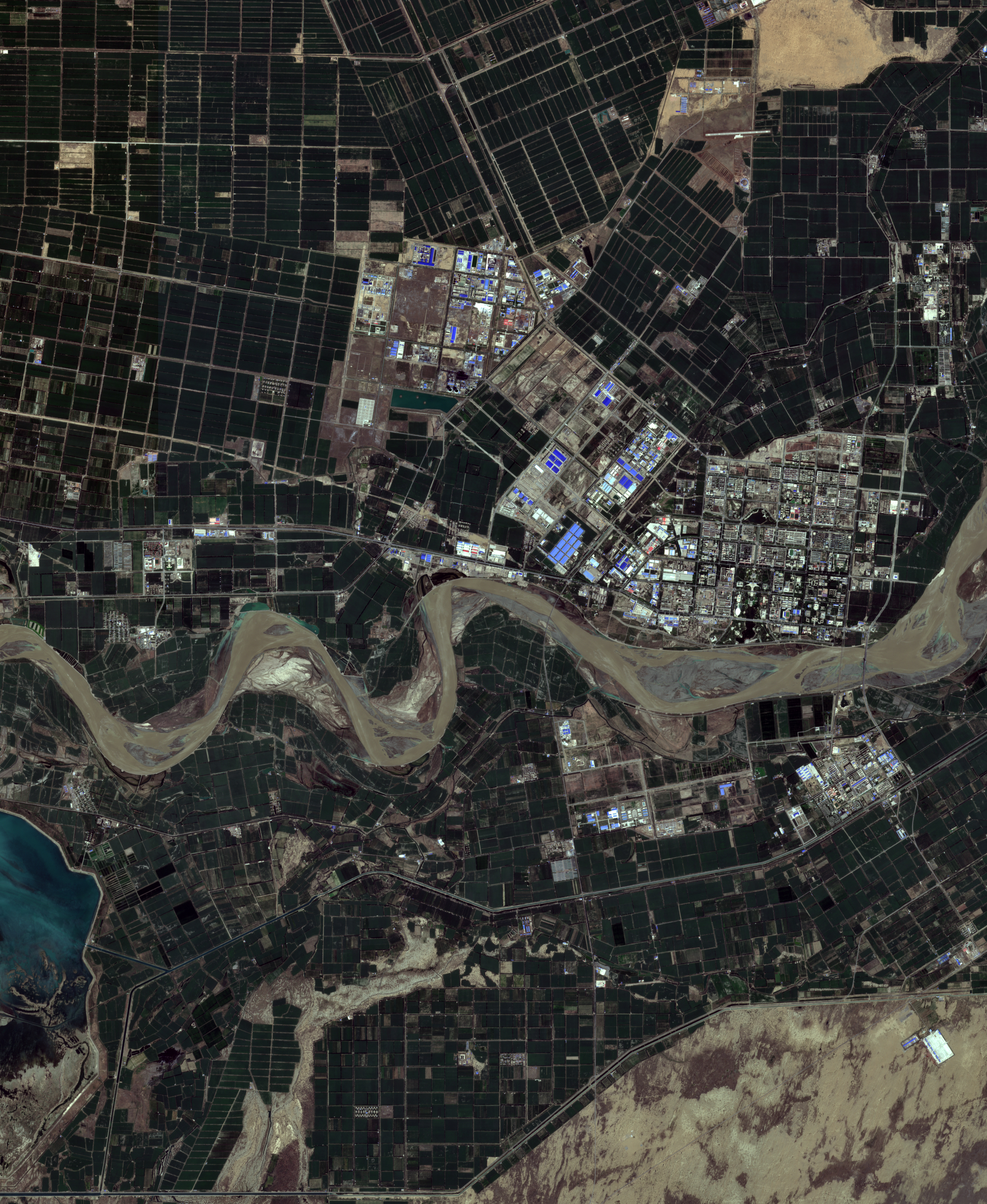
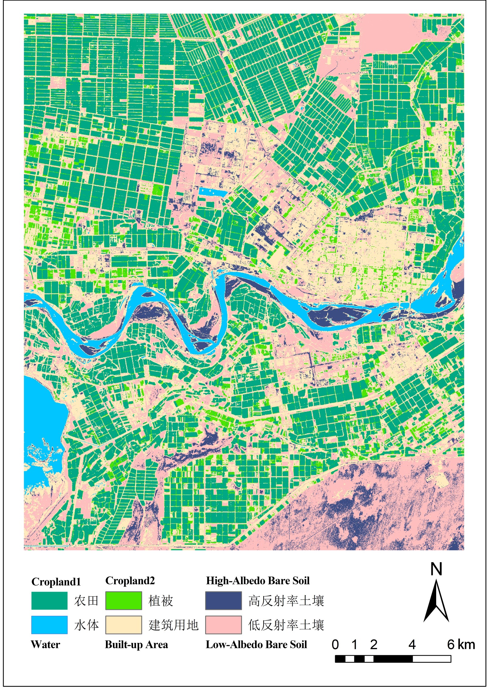
Land Cover Classification
Based on remote sensing imagery, land cover classification methods primarily include supervised classification, unsupervised classification, and object-oriented classification. This map utilizes a supervised classification approach, integrating the Normalized Difference Vegetation Index (NDVI) and the Modified Normalized Difference Water Index (MNDWI), to categorize features into six types: vegetation, built-up land, water bodies, cropland, high-albedo soil, and low-albedo soil.
Soil albedo is primarily influenced by moisture content. Based on the actual conditions in the imagery, an MNDWI value of -0.1 is used as the threshold: areas with values greater than -0.1 are classified as low-albedo soil, while those with values less than -0.1 are classified as high-albedo soil.
Finally, the classification accuracy was validated using a confusion matrix, achieving an overall accuracy of 96.51%.