Landscape Ecological Assessment
Data: Landsat satellite image, DEM
Tools: ENVI, Arcgis pro, Fragstats
Description: This project originated from the undergraduate course "Landscape Ecology." It integrates remote sensing, GIS spatial analysis, and landscape ecology metrics to quantitatively analyze the spatio-temporal evolution of landscape patterns and their impact on Ecosystem Service Value (ESV) in Guangzhou's Liuxi River Basin from 2010 to 2020. The research provides a scientific basis for landscape ecological planning, management, and sustainable development of the watershed. Key workflow inciuding:
1. Demarcating the watershed via DEM data processing;
2. Performing land classification through supervised classification of satellite imagery;
3. Calculating landscape pattern indices;
4. Constructing land use transition matrices;
5. Conducting an ESV assessment.
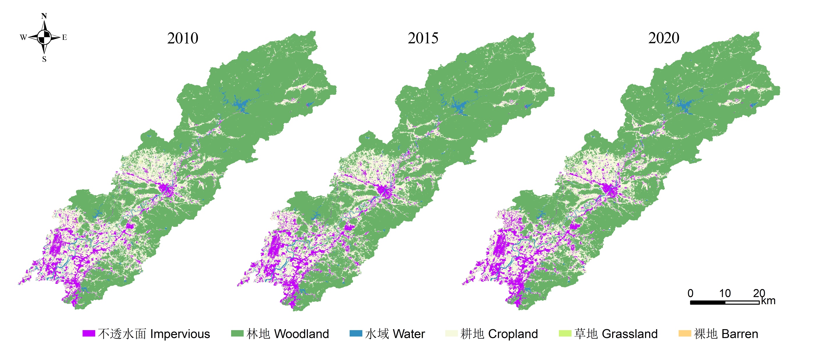
Liuxi River Basin
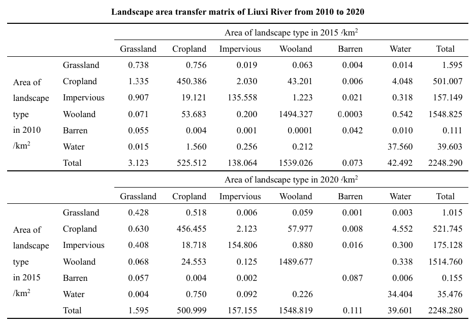
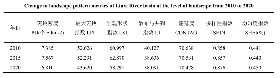
Examples of Tables