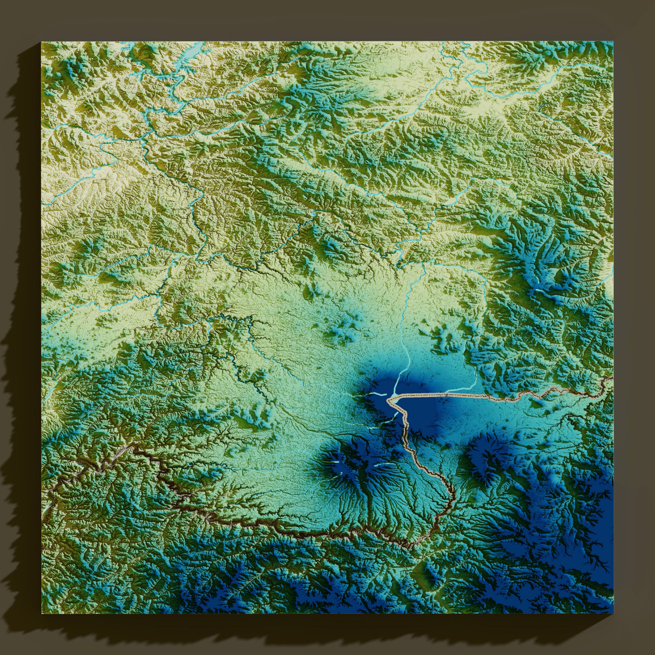
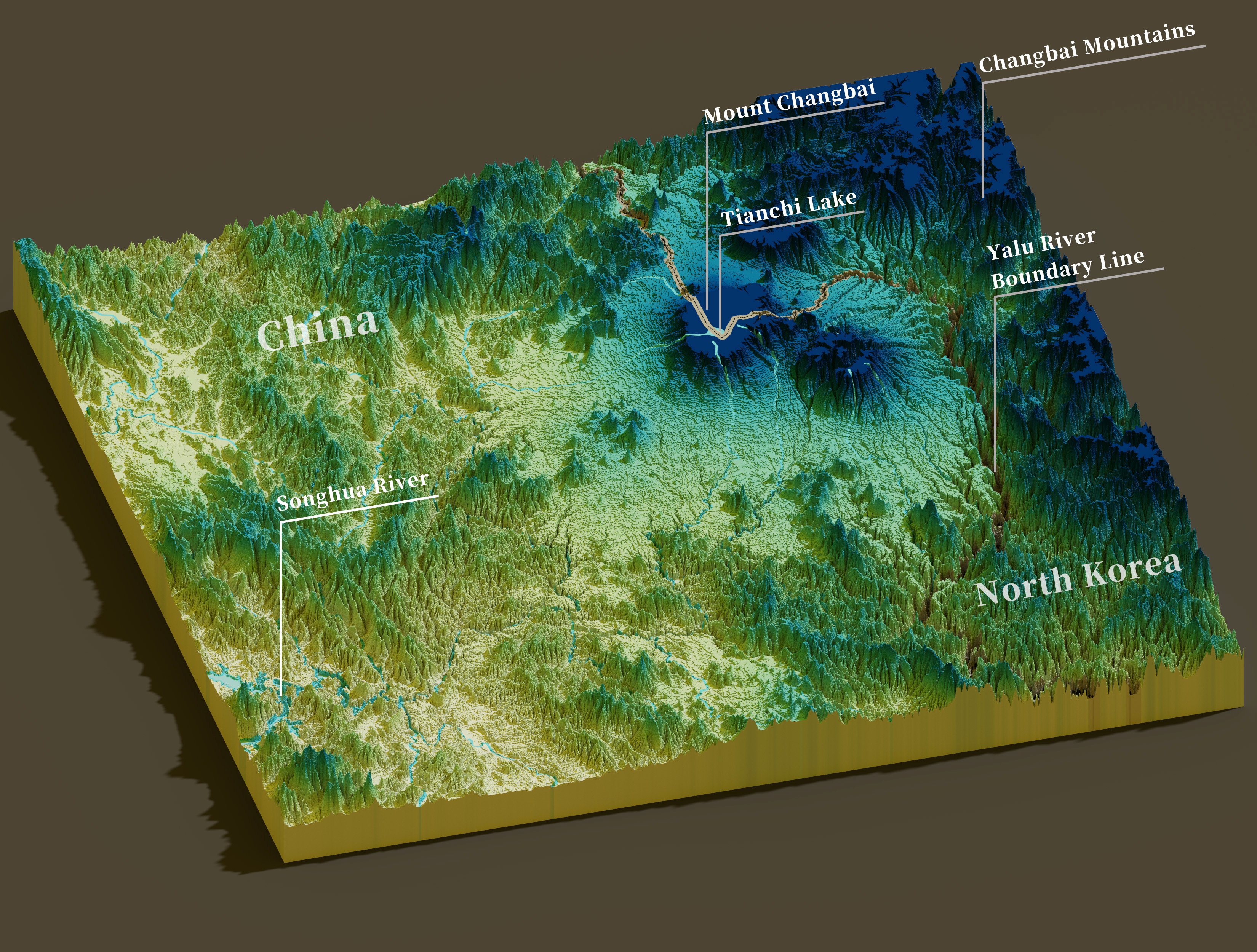
3D DEM
This is a personal recreational project. The workflow involved processing DEM data in ArcGIS Pro, then importing it into Blender for parameter design and rendering (a simpler alternative is to use Aerialod).
This 3D DEM depicts Changbai Mountain in northeastern China, a renowned tourist destination. The mountain straddles the national border, with the volcanic crater lake, Tianchi, split by it—one side belongs to China and the other to North Korea.
The color scheme for the 3D DEM was inspired by the ancient Chinese masterpiece, "A Thousand Li of Rivers and Mountains."
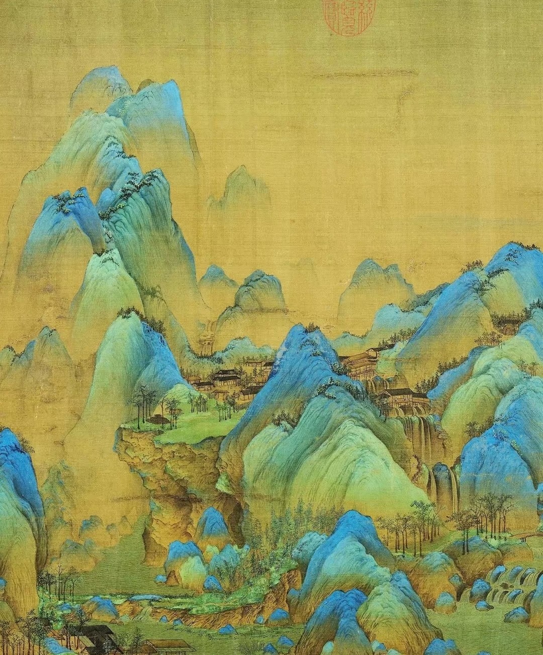
A Thousand Li of Rivers and Mountains
Wang Ximeng, Song Dynasty
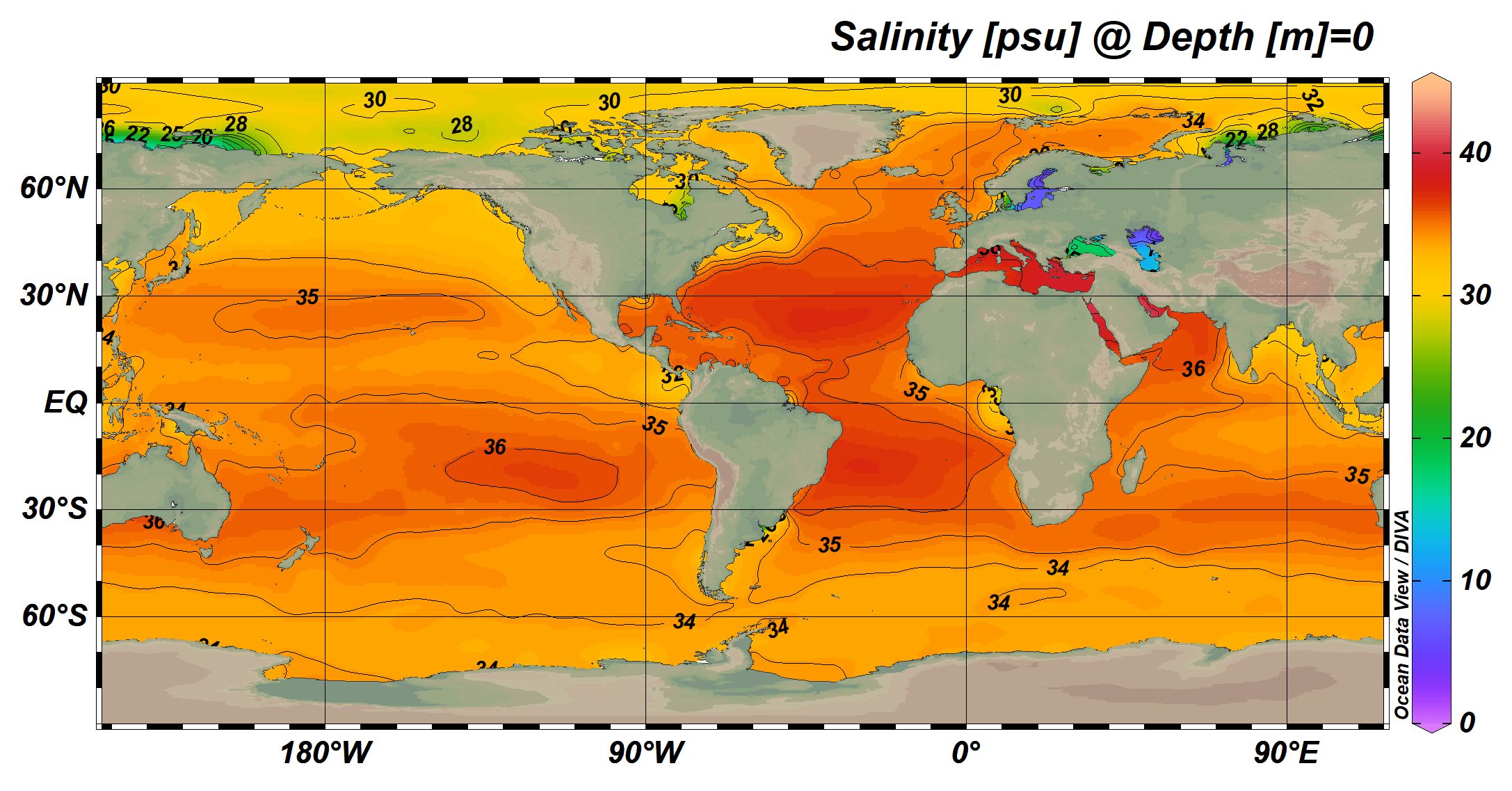
Global Sea Surface Temperature & Salinity
Data: World Ocean Atlas (WOA)-2018
Tools: Ocean Data View (ODV)
Description: WOA-2018 offers temperature and salinity data derived from the mean climatic field spanning 1955 to 2017, which is calculated as the average of six decadal averages. January and July data were chosen as representative of winter and summer conditions.
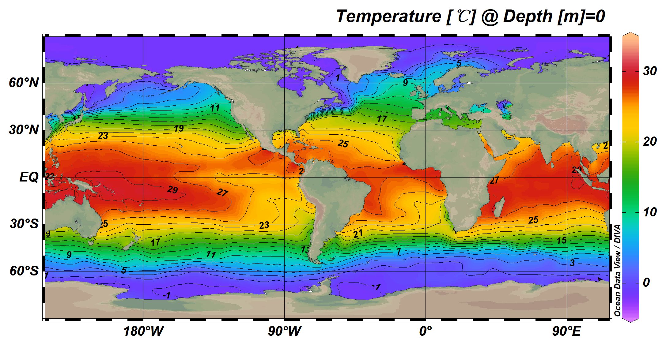
Jan.
Jan.
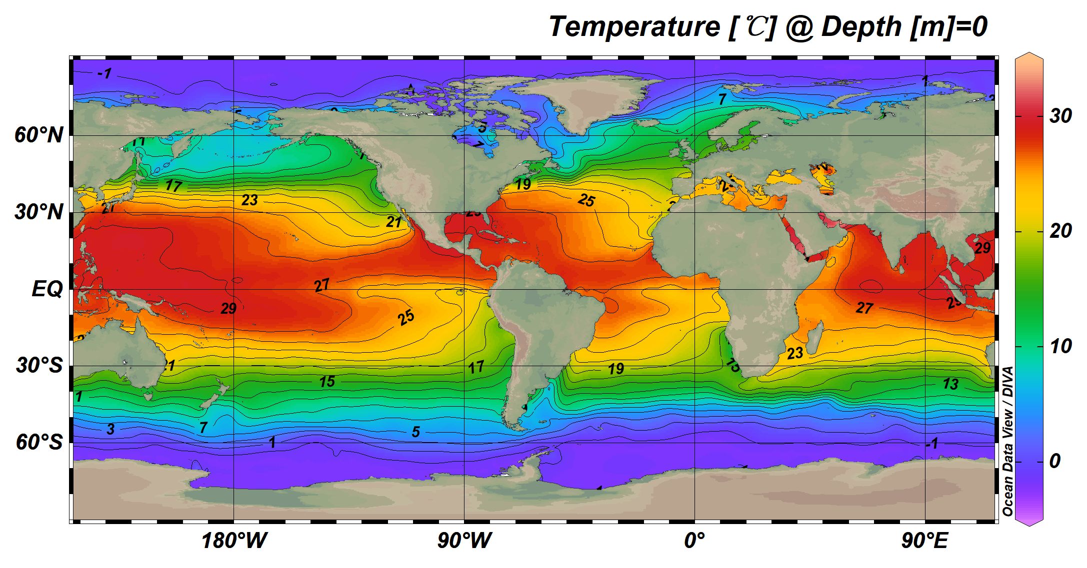
Jul.
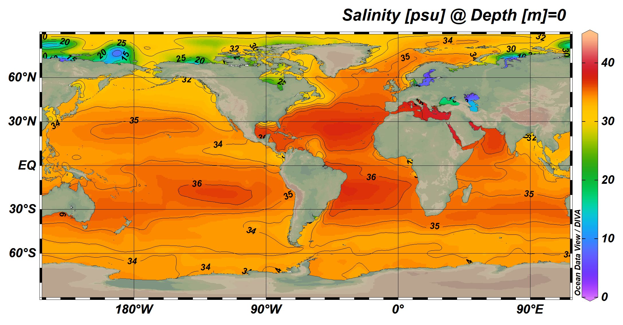
Jul.
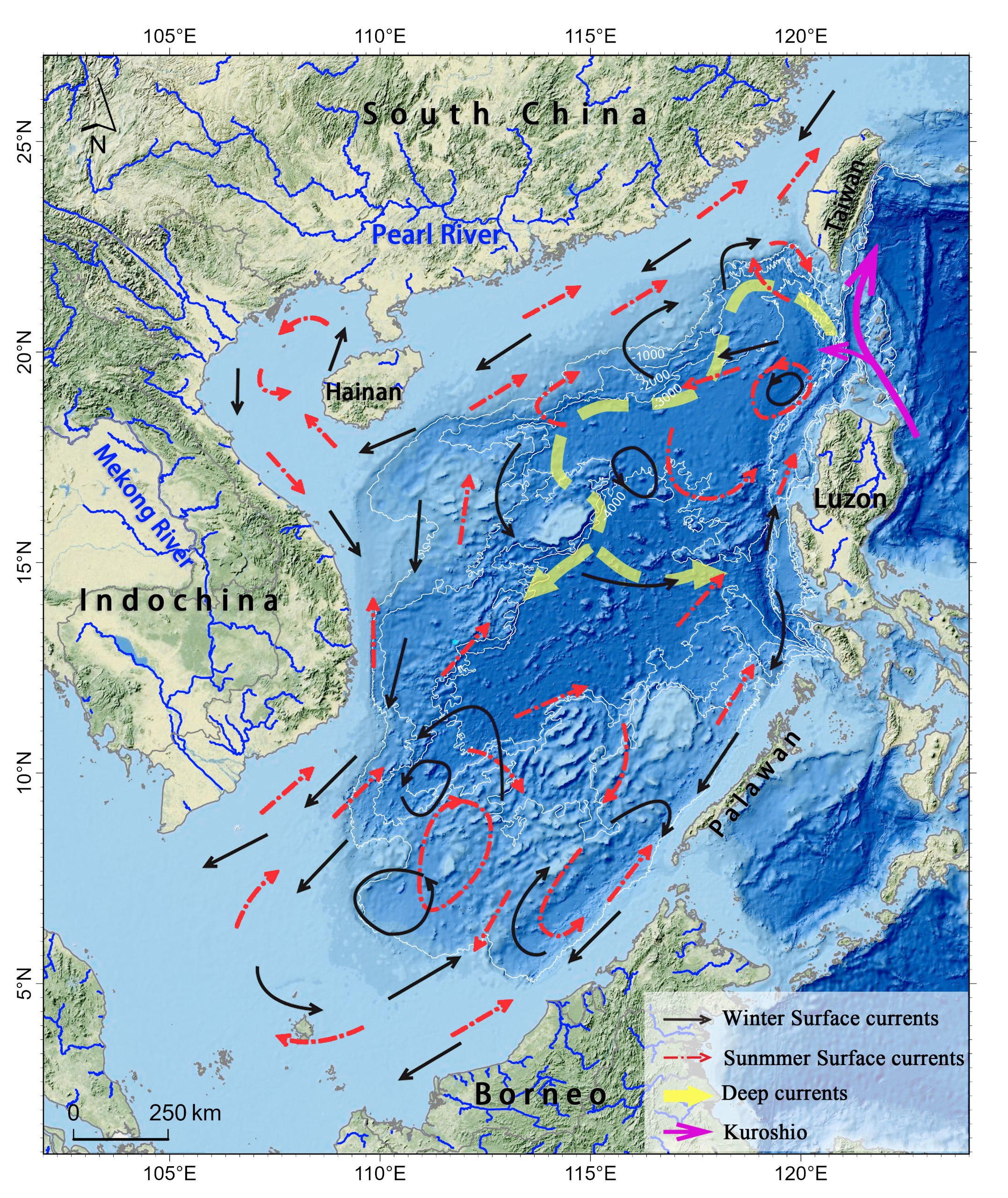
Current map of the South China Sea